us army corps of engineers logo - white castle on red background

Norfork Lake 

Shoreline Management and Master Plan


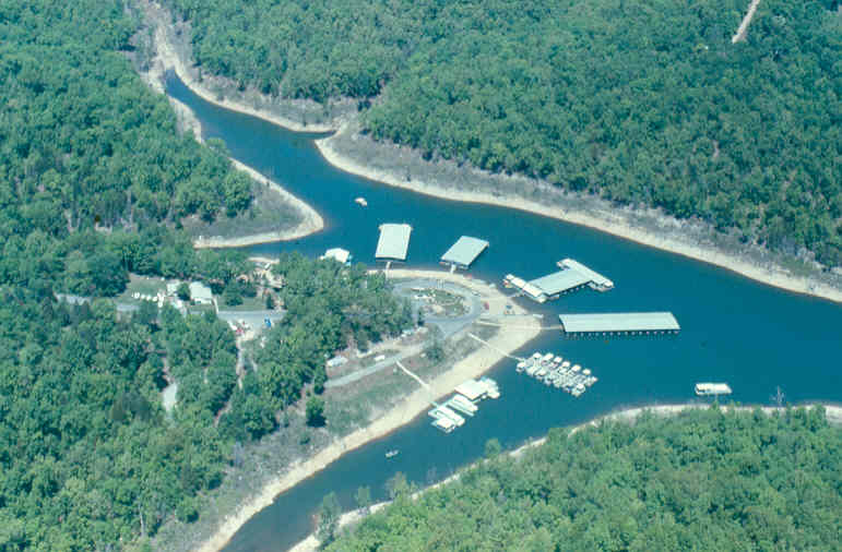
Shoreline Management:

The Shoreline Management Plan (SMP) establishes policy and furnishes guidelines for the protection and conservation of the desirable environmental characteristics of the lake while maintaining a balance between public and private shoreline uses.  The SMP provides for the effective long-range management of the shoreline resources of Norfork Lake.  This SMP describes the types of private uses and activities that may be permitted on public lands. Management of the shoreline will provide a balance between recreational use, the environment, and project resources.  The objectives of the SMP are to manage and protect the shoreline; to establish and maintain acceptable fish and wildlife habitat, aesthetic quality, and natural environmental conditions; and to promote the safe and healthful use of the lake and shoreline for recreational purposes by all users.  At the top of conservation pool elevation, (552 MSL), Norfork Lake has a shoreline of 380 miles.  As the pool rises to the top of flood control pool elevation, (580 MSL), the shoreline miles increase to 510 miles. The Norfork Project area contains 22,000 surface acres of water.   Public Land managed by the U.S. Army Corps of Engineers surrounds the lake. The boundaries of public land are defined by the Government Fee Take Line (GFTL). The GFTL consists of a straight line from monument to monument.  The boundary markers, or monuments, are topped with a brass cap, which indicates the tract of land which was purchased from the land owner.  Ownership of private land does not convey any exclusive rights to the use of adjoining public lands, or to the lake.  The general public can use public lands.  Shoreline Use Permits or Licenses may be issued within the guidelines of ER 1130-2-406, dated 27 July 1990, Shoreline Management at Civil Works Projects, SWLOM 1130-2-23, dated 15 September 1993; and the SMP for Norfork Lake, dated 28 August 1998.

Collapse All Expand All
 Private Floating Facilities ( Boat docks)

Private docks are permitted only in areas designated as Limited Development Areas.  The official maps may be seen at the Mountain Home Project Office in Mountain Home, AR. Applicants for boat  docks must have ready access to the shoreline either by ownership of  adjoining property (within 200 lateral feet of the Government Property   Line) or deeded perpetual lake access. The facility must serve as the homeport for boat (s) of the owners of the dock, and the owner of each boat moored in the dock must own interest in the dock. Renting slips in a boat dock is prohibited. Boat docks must have a minimum spacing of 100” between docks at the 552 m.s.l. Each individual household family can have a maximum of two slips and will not be permitted ownership in more than one boat dock. Current valid state boat registrations will be required with the permit application to support boat ownership and the need for mooring space. Boat docks will be anchored perpendicular to the shoreline. (Please contact the Duty Ranger at the Mountain Home Project Office for further information and requirements) Solar electric is strongly encouraged as no new electric easements are issued by the Corps of Engineers.

 Project Boundary

The real property fee acquisition line for Norfork Lake, as a general rule, was blocked out along 580 m.s.l.  Property ownership lines where private property lays below 580 m.s.l., flowage easements were acquired.  The Government Property Line (GPL) is a very uneven line rather than a contour line around the lake. The entire boundary line on Norfork Lake has been surveyed and monumented and is defined by survey monuments placed at ground level. The survey markers are 3 ½ -inch diameter, round brass caps stamped to show the monument number, the year surveyed, and the agency, Little Rock Corps  of Engineers, U S. Army. A five-foot white, steel fence post is set approximately one-foot from the survey marker or monument, between the monument and the water’s edge. Some trees along the boundary line are marked with a white blaze or band as an additional aid to location of the GPL. These trees however are usually off-line and indicate that the GPL is nearby.  Adjoining property owners are encouraged to build permanent structures a sufficient distance back from  the Government Property Line (GPL) to allow for maintenance of the structure and reduce the possibility of an encroachment by the subsequent addition of decks, porches, steps, patios, extension of landscaping or backyard appearance, etc. Other than pedestrian access, or general public recreation activities, any activity on public land not authorized by a permit/outgrant may be considered an encroachment, trespass, or degradation of public property and is a violation of the Rules and Regulations contained in Title 36, Code of  Federal Regulations 327.

 Real Estate Instruments

Requests involving commercial development, rights-of-way, changes in the landform (steps, stairs, waterlines, power lines, grading, cutting or fills) launching ramps, roads or establishment  of land-based support facilities will be evaluated by the Little Rock  District Real Estate Branch. Approval will be granted by the Chief, Real Estate Branch. Contact the Mountain Home Project Office for assistance and information. Flowage easements were acquired above the blocked out fee acquisition line up to, as a general rule, elevation 580 m.s.l. A flowage easement gives the government the perpetual right to flood privately owned land, if necessary, for the operation of the project and to prohibit any structures for human habitation or sewage facilities. Other types of structures on flowage easement must be approved prior to construction. In those areas where acquisition of easements on extremely small areas was not practical, the blocked out line for fee acquisition was extended to include the easement contour.

 Shoreline Allocation and Permits

The shoreline of Norfork Lake is currently allocated into four major categories in accordance with 36 CFR 327.30, Shoreline Management of Civil Works Projects. These allocations extend from the water’s edge to the project boundary for land-bases uses and from the shoreline water ward for floating facility considerations.  The four categories are: (1) Limited Development Area. Private floating facilities, vegetative modification, footpath construction, ambulatory   assistant vehicle permits, and limited motel/resort leases are permitted in this allocation. (2) Public Recreation Areas. No shoreline use permits will be issued. (3) Protected Shoreline Areas. Shoreline use permits will not be issued for floating facilities in these zones. Vegetation modification and footpath construction may be permitted in these areas, but are at the discretion of the Operations Project Manager. (4)  Prohibited Access Areas. No shoreline use permits will be issued. Ownership of adjacent private property does not convey any exclusive or preferential rights to the use of the lake or adjoining lands. An application must be submitted for a permit prior to constructing boat mooring facilities, altering the terrain or modifying vegetation on public land. Shoreline use permits are issued for: (1) boat docks, (2) pedestrian foot paths, (3) vegetation modification, and (4) ambulatory assistance vehicular access. A fee will be charged for the Shoreline Use Permits to help defray expenses associated with the issuance, administration of the permits, and inspections.

 Vegetation Modification
Mowing or under brushing may be permitted for fire protection purposes only. The limits of mowing/under brushing will depend on the proximity of the habitable structure to the Government Property Line and other private boundaries. The maximum allowed limits of mowing will be a radius of 33 feet from the foundation of a habitable structure to the public land. Shoreline modification are subject to the following  conditions: trimming, limbing or topping of trees is prohibited; only  hand-operated tools and noncommercial riding lawn mowers may be used;  trees larger that 2-inch diameter (measured 4.5 feet from the ground) may       not be removed. No flowering trees or shrubs, including but not limited to dogwood, redbud, serviceberry, deciduous holly, hawthorn species and buck berry bush may not be cut regardless of size. A permit is required prior to any work on government property. Pedestrian path to the lake, six feet       or less in width may be permitted. The path must follow a meandering route to prevent erosion and avoid the need for removal of trees, vegetation or leaves. The permit does not convey the right to construct any structure (steps, bridges, etc) in connection with the path. No landscape lighting is permitted. Dead trees or broken limbs which may cause damage to private property, or obstruct a path may be cut. A ranger will inspect and approve any removal of hazardous trees or limbs.

Contact Us

Mountain Home Project Office
324 W. 7th Street
 Mountain Home, AR 72653
 Phone: (870) 425-2700
 Fax: (870) 425-3795
Duty Ranger: 501-340-1400
Office Hours: M-F, 8:00am – 4:30pm
Closed on Federal Holidays
 ceswl-mh@usace.army.mil