The Floodplain Management System program (FPMS) is authorized by Section 206 of the 1960 Flood Control Act (PL 86-645) as amended, and has been used in Arkansas and Missouri to analyze flood risk management information for many years. From flood inundation mapping to floodplain mapping to flood duration and frequency analyses, the Little Rock District has used the FPMS program to assist many communities with their flooding problems and concerns.

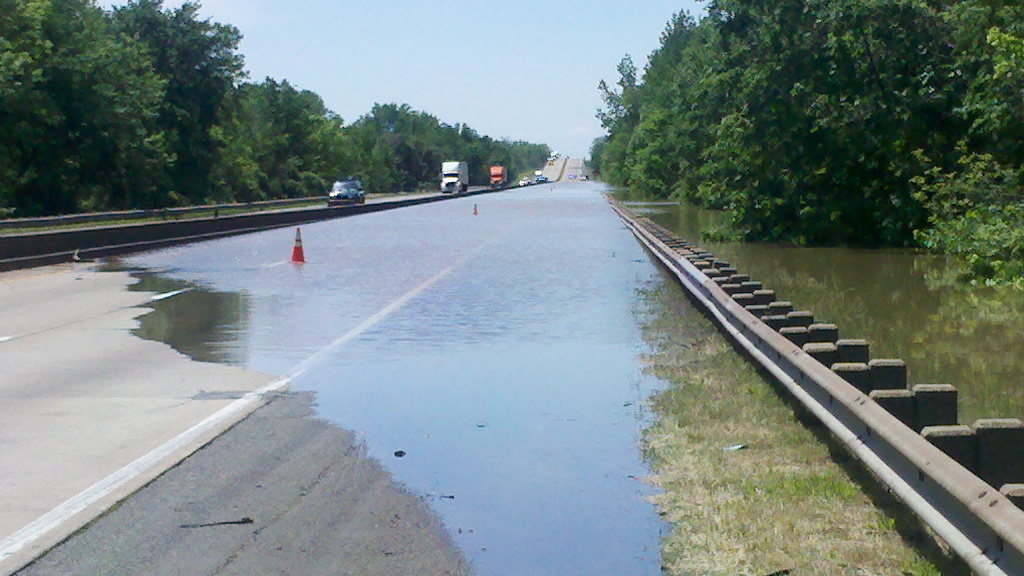
This is a picture of the flooding that occurred along the White River in 2011 that closed Interstate 40 for a period of time.
The Arkansas Silver Jackets team analyzed this event and determined that most of the flooding that occurred along the
White River in 2011 was caused by both the record flooding on the Mississippi River and rainfall in the White River basin----
an event that statisticians call "coincidental flooding" and was determined to be a 100 - 200 year event at the I-40 crossing.
There are two avenues that the Corps of Engineers utilizes FPMS to help communities, Tribes and state governments: General Technical Services, General Planning Guidance. Additionally, the Silver Jackets Program is a product of FPMS and Arkansas and Missouri both have very active Silver Jackets programs.

Pictured above is the Arkansas Silver Jackets Team. The agencies being represented are: Arkansas
Department of Emergency Management; Arkansas Natural Resources Commission, Arkansas Game and
Fish Commission, National Weather Service, FEMA, and USACE.
Whether you have basic, non-technical floodplain questions or complex flooding issues or concerns, we encourage you to contact the Little Rock District for assistance. FPMS services and projects are provided for State and local governments, Indian Tribes and other non-Federal public agencies without charge. These services and projects can be provided to non-water resource Federal agencies and to the private sector on a 100% cost recovery basis. For more information, access the link below to download an information sheet or call 501-324-7342.

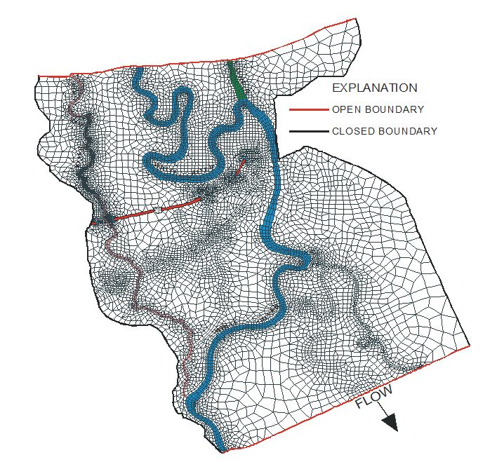
This is a screen capture of a grid for a multi-dimensional flow model. Grids are used to
compile flow models that help with understanding flow patterns, velocities and flood heights
of rivers and streams throughout the country.