DeQueen Lake Header

US Army Corps of Engineers logo - white castle on red background DeQueen Lake

DeQueen Lake Contact Card

Contact DeQueen Field Office

Location

DeQueen Field Office

706 DeQueen Lake Road
DeQueen, Arkansas 71832

Phone Number

Field Office: (870) 584-4161

Campground Contacts

Oak Grove / Pine Ridge:
(870) 642-6111

Bellah Mine Park:
(870) 386-7511

DeQueen Lake

Southwest Arkansas recreation destination offering quality camping, fishing, and outdoor activities managed by the U.S. Army Corps of Engineers

Shoreline

32 miles

Surface Area

1,424 acres

Campgrounds

3 Parks

Campsites

73 Total

Lightning strike on DeQueen Lake

The U.S. Army Corps of Engineers welcomes you to DeQueen Lake and wishes you an enjoyable stay at the project. The project offers the visitor extensive opportunities for a memorable outdoor recreation experience. Food, bait, tackle, and other supplies are available near the lake.

DeQueen Lake, located in Southwest Arkansas, provides year-round recreation opportunities including camping, fishing, boating, swimming, picnicking, and hunting. The lake's 1,424-acre surface and 32 miles of shoreline offer visitors a peaceful retreat in a natural setting. Project personnel are available and will be happy to assist in assuring you a pleasant stay.

Campgrounds

Three developed campgrounds with 73 total campsites and modern facilities

DeQueen Lake offers three quality campgrounds providing a total of 73 campsites with modern amenities. All campgrounds are open year-round with reduced rates during the off-season.

Bellah Mine Park

Description: Bellah Mine Park is located on the northern end of DeQueen Lake. The park includes 24 shaded campsites, some of which are located on the water.

Location: From DeQueen, AR, take US Highway 71 N for 7 miles to Bellah Mine Road. Travel Bellah Mine Road west for 5 miles, following signs into the campground.

Facilities

  • 24 campsites with electricity and water
  • Showers and flush toilets
  • Trailer dump station
  • Picnic areas and picnic shelter
  • Boat ramp

Fees: $14-$16 (March 1 - Oct. 31) | $10 (Nov. 1 - Feb. 28)
Picnic shelter rental: $25

Reservations: Recreation.gov - Bellah Mine

Contact: (870) 386-7511
For any questions concerning your stay at Bellah Mine Park

Oak Grove Park

Description: Oak Grove has 36 campsites. Although shade is limited on most sites, pavilions provide shade on most campsites. A group camping area with pavilion and tent sites is available.

Location: From DeQueen, AR, travel 3 miles north on US 71, then 5.3 miles west on DeQueen Lake Road, then 0.3 miles north on Corner. Follow signs into the campground.

Facilities

  • 36 sites with water and electricity
  • Trailer dump station
  • Showers and flush toilets
  • Playground
  • Amphitheater
  • Boat ramps
  • Swim beach
  • Picnic areas and shelter

Fees: $14-$16 (March 1 - Oct. 31) | $10 (Nov. 1 - Feb. 28)
Picnic shelter: $25 (March 1 - Oct. 31)

Reservations: Recreation.gov - Oak Grove

Contact: (870) 642-6111
For any questions concerning your stay at Oak Grove or Pine Ridge parks

Pine Ridge Park

Description: Pine Ridge park includes 17 campsites with sites located on the water. A mix of pine and hardwood trees offer shade to all campsites.

Location: From DeQueen, AR, go 3 miles north on US 71, then 5.5 miles west on DeQueen Lake Road, then 1.5 miles west on the county road.

Facilities

  • 17 campsites with water and electricity
  • Showers and flush toilets
  • Trailer dump station
  • Picnic shelter
  • Boat ramp

Fees: $14-$16 (March 1 - Oct. 31) | $10 (Nov. 1 - Feb. 28)
Picnic shelter: $25 per day

Note: All reservations and payments are made at the Gate Shack located in Oak Grove park.

Reservations: Recreation.gov - Pine Ridge

Contact: (870) 642-6111
For any questions concerning your stay at Oak Grove or Pine Ridge parks

Recreation Activities

Boating, fishing, swimming, picnicking, and hunting opportunities

Whether you enjoy boating, fishing, skiing, or canoeing, DeQueen Lake has everything you need. There are three campgrounds, six boat ramps, three swimming areas, many picnic areas, and three picnic shelters. Please remember whatever your recreational interest – play it safe at the lake.

Boating

Boating on DeQueen Lake

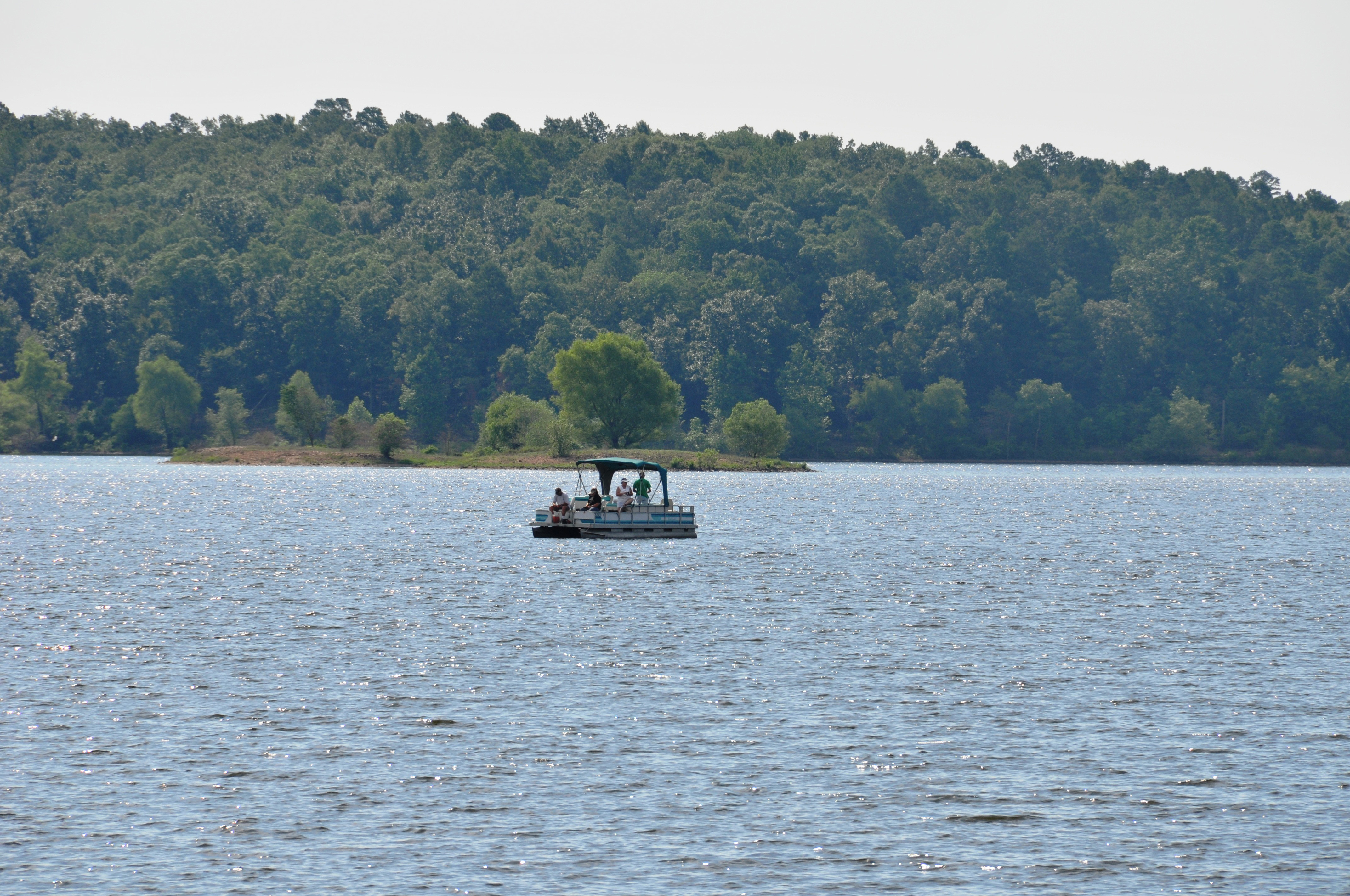
Launching ramps are provided in the park areas for easy loading and launching of boats. Boating on DeQueen Lake is in accordance with Arkansas State boating laws and Corps of Engineers regulations.

Safety First: Operate your boat in a controlled, safe manner. Stay away from buoyed areas. Diving areas are marked by a red flag with a white diagonal stripe.

Regulations governing operational requirements of boats may be obtained at the DeQueen Project Office near the dam.

Fishing

Fishing at DeQueen Lake

The region in which DeQueen Lake is located offers outdoor sportsmen excellent opportunities for year-round enjoyment of the project.

Fish Species:

  • Largemouth Bass
  • Smallmouth Bass
  • Spotted Bass
  • Black and White Crappie
  • Channel and Flathead Catfish
  • Various species of Sunfish
  • Hybrid Striped Bass (stocked by Arkansas Game and Fish Commission)

Swimming

Beautiful swim beach at DeQueen Lake

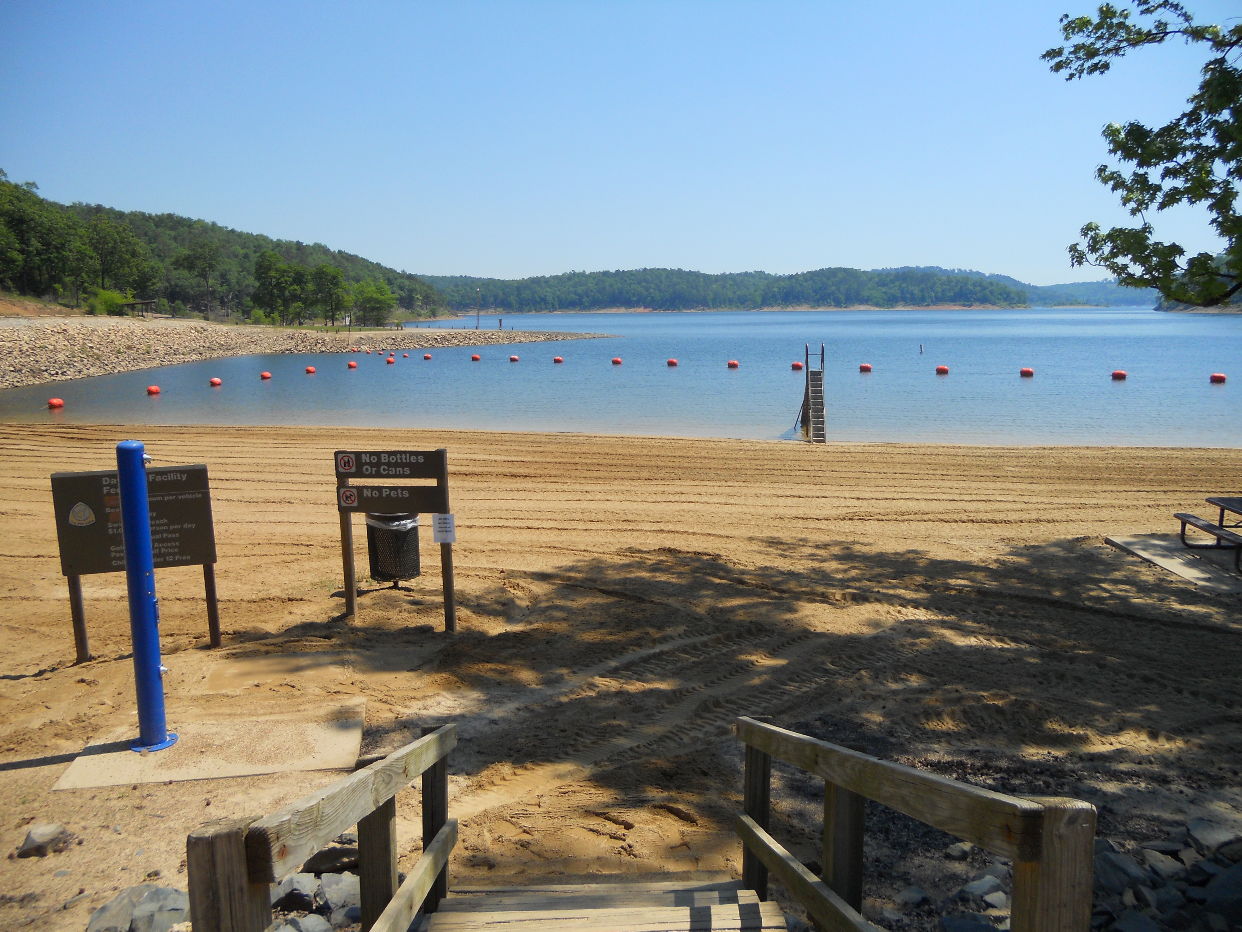
3 Designated Swim Areas

There are 3 designated swimming areas on DeQueen Lake located at Oak Grove, Rolling Fork, and Storey Creek.

Users must pay a daily fee of $5 per vehicle or may purchase an annual pass for use of the beaches.

Water Safety Guidelines:
  • Swim only in designated swimming areas
  • Never swim alone
  • Never rely on toys such as inner tubes and water wings to stay afloat
  • Don't take chances by overestimating your swimming skills
  • Never dive into lakes and rivers - diving accidents cause over 8,000 paralyzing spinal cord injuries annually
  • Watch your children at all times - it only takes seconds for a child to wander away
  • Don't drink alcohol if you are planning to have fun in or on the water

Picnicking

Enjoying the picnic sites at Glen Canyon Park

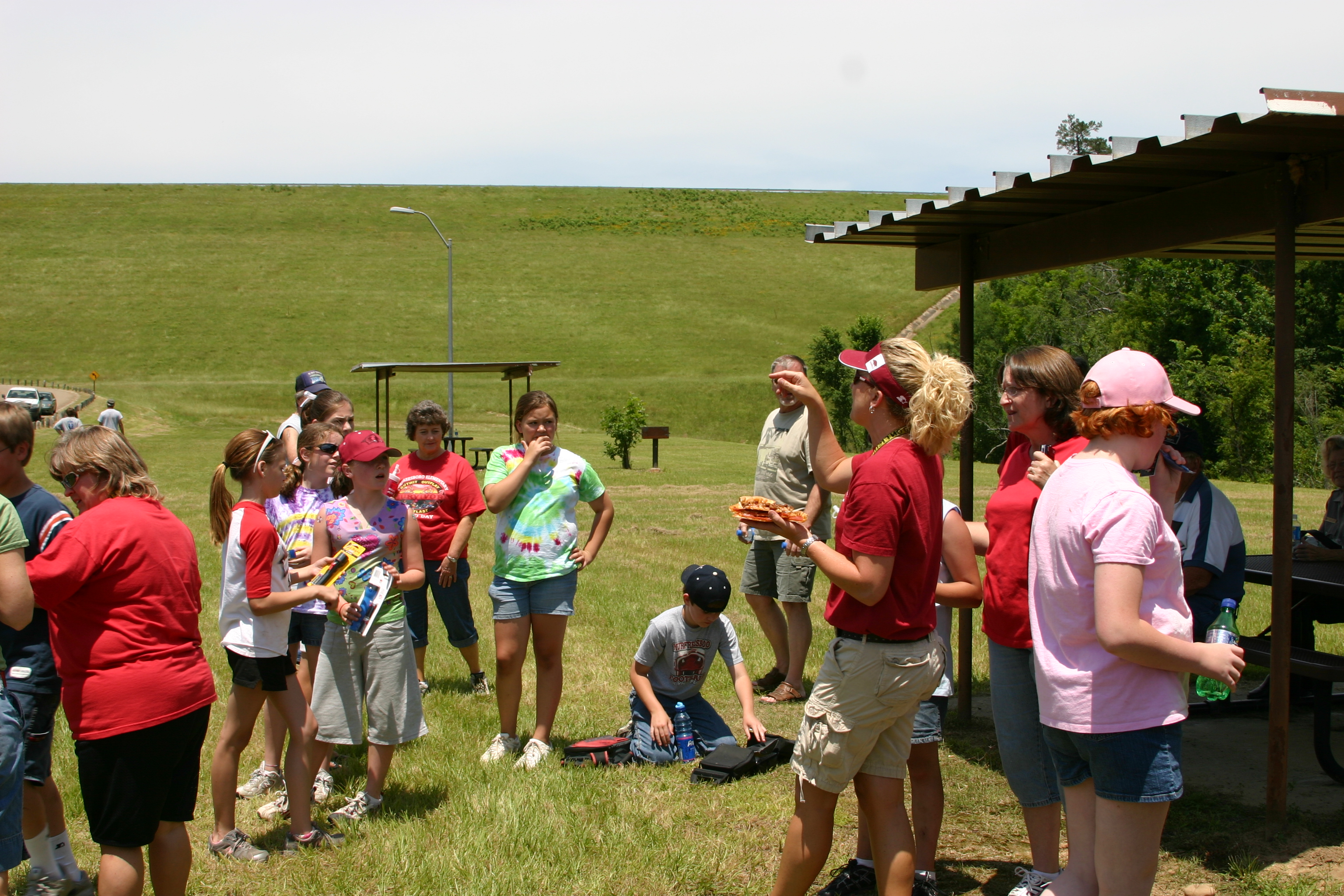
Picnicking areas are available at many sites on DeQueen Lake. There are many designated picnicking areas and three picnicking shelters, which are great for family reunions.

Picnic Shelter Features:

  • Lighted facilities
  • Equipped with barbeque grills
  • Electricity available
  • Close proximity to the lake

Shelter Locations: Glen Canyon, Rolling Fork, Storey Creek, Oak Grove, Pine Ridge, and Bellah Mine

Shelter Rentals:
Oak Grove/Pine Ridge: (870) 642-6111
Bellah Mine: (870) 386-7511

Hunting

Deer hunter with harvest

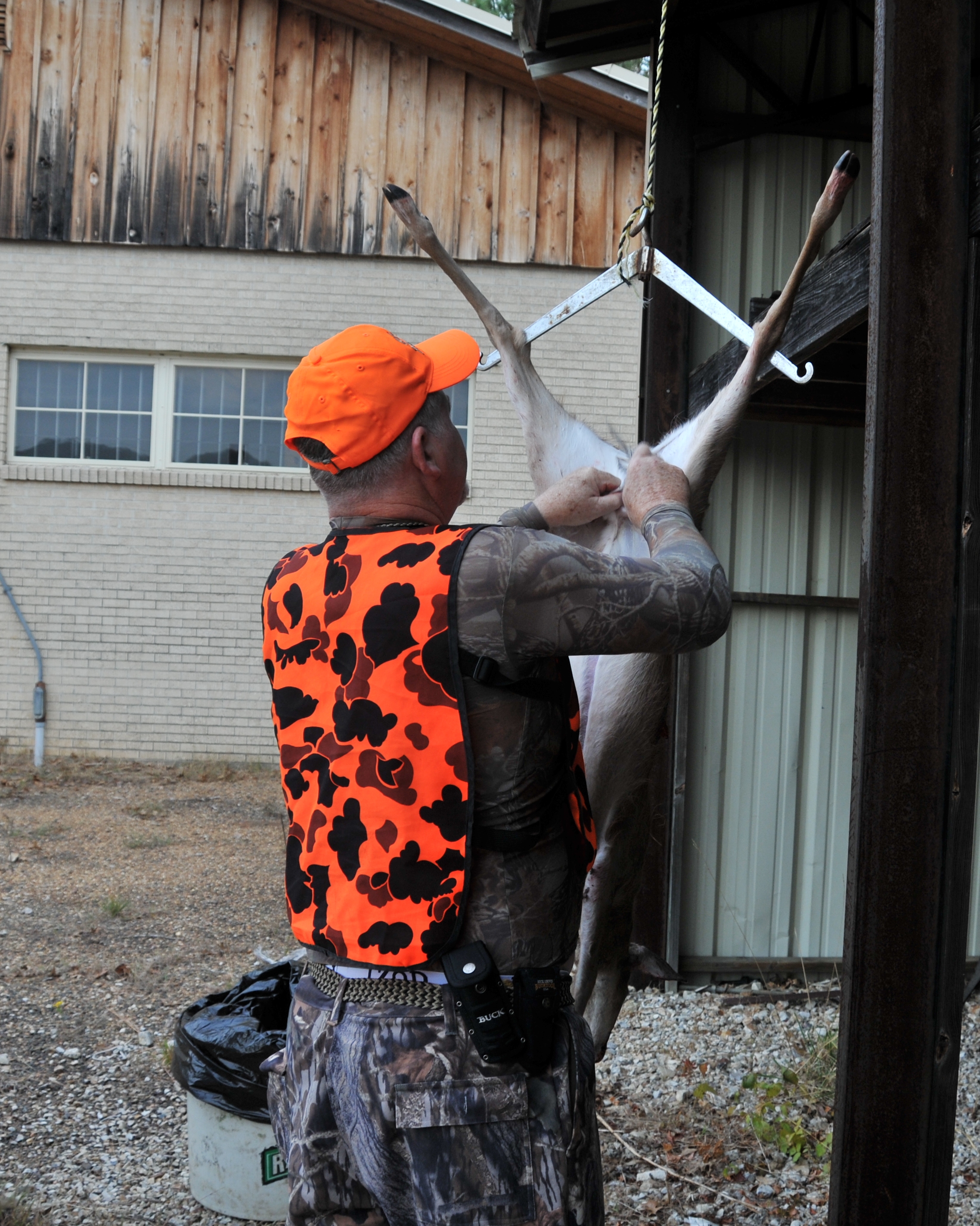
Opportunities for hunting on project lands are equally good for the hunting enthusiast. Except for developed recreation areas and lands in the vicinity of the dam and other project structures, all project lands are open to the public for hunting.

Principal Game Species:

  • Bobwhite Quail
  • Mourning Dove
  • Wild Turkey
  • Squirrel
  • Cottontail Rabbit
  • White-tailed Deer
Hunting Restrictions: Hunting is not permitted in developed recreation areas or lands in the vicinity of the dam and other project structures.

Shoreline Management

Government land boundaries, regulations, and property information

Snowfall on the shoreline at DeQueen Lake

The Corps of Engineers owns about 8,700 acres of land surrounding DeQueen Lake. At the top of conservation pool, 437.0 mean sea level, DeQueen Lake provides 32 miles of shoreline for its visitors to enjoy.

Boundary Line Identification

The boundary line which identifies government land is irregular and is not a set distance from the lakeshore.

Boundary Markers:

  • Brass survey monuments: Placed at ground level to define the boundary
  • Five-foot red steel fence posts: Set about one foot from the monument, between the monument and the water's edge, to aid in locating the boundary line
  • Red four-inch wide bands on trees: Trees along the boundary line are marked with red bands as identifying markers (note: these trees are off-line and indicate only that the boundary line is nearby)

Shoreline Regulations

Important Restrictions:
  • DeQueen Lake is NOT zoned for commercial or private boat docks
  • The Corps of Engineers does NOT issue permits for land alterations
  • Vegetation modification is NOT permitted
  • Meandering paths are NOT permitted
  • Fire protection structures are NOT permitted
Need Assistance Locating Boundaries?
Park Rangers are available to assist you in locating government boundary lines.
Contact: (870) 584-4161

Natural Resources

Wildlife habitat, environmental management, and conservation efforts

Whitetail deer fawns at a campsite on DeQueen Lake

Wise management of natural resources on and around DeQueen Lake is necessary and important to maintain the quality environment we enjoy. The public land that surrounds the lake provides a buffer that ensures high quality water, as well as habitat for the abundant wildlife and plants found here.

Management Goals

Our goal for managing this land is to restore it to natural conditions and enhance native plant and animal populations. Comprehensive natural resource plans are developed to guide our efforts toward accomplishing this goal.

Cooperative Management: The Corps of Engineers, Arkansas Game and Fish Commission, and volunteer groups play important roles in the cooperative management of hunting and non-hunting areas.

Environmental Benefits

  • Water Quality Protection: Public lands provide a buffer zone ensuring high-quality water
  • Wildlife Habitat: Diverse ecosystems support abundant wildlife populations
  • Native Plant Restoration: Ongoing efforts to enhance native vegetation
  • Biodiversity Conservation: Protection of diverse plant and animal species

Common Wildlife

Visitors to DeQueen Lake can expect to encounter a variety of wildlife species including:

  • White-tailed Deer
  • Wild Turkey
  • Various waterfowl species
  • Songbirds and raptors
  • Small mammals (squirrels, rabbits, etc.)
  • Reptiles and amphibians

Dam and Lake Information

Project details, water levels, and technical specifications

Lake Statistics

  • Conservation Pool: 437.0 feet mean sea level
  • Surface Area: 1,424 acres at conservation pool
  • Shoreline Length: 32 miles
  • Government-Owned Land: Approximately 8,700 acres

Real-Time Information

Current Water Levels:
For real-time lake level data and information, visit:
DeQueen Lake Water Levels

Project Purpose

DeQueen Lake was created by the U.S. Army Corps of Engineers to provide:

  • Flood risk management
  • Water supply
  • Recreation opportunities
  • Fish and wildlife habitat
  • Water quality maintenance
DeQueen Field Office
706 DeQueen Lake Road
DeQueen, Arkansas 71832
Phone: (870) 584-4161