The Bull Shoals Lake project on the White River is located within Southern Missouri (Taney and Ozark counties) and Northern Arkansas (Boone, Marion, and Baxter counties) and was authorized by the Flood Control Act of June 28, 1938. The lake is about 104,574 acres of land and water with 959 miles of boundary line.
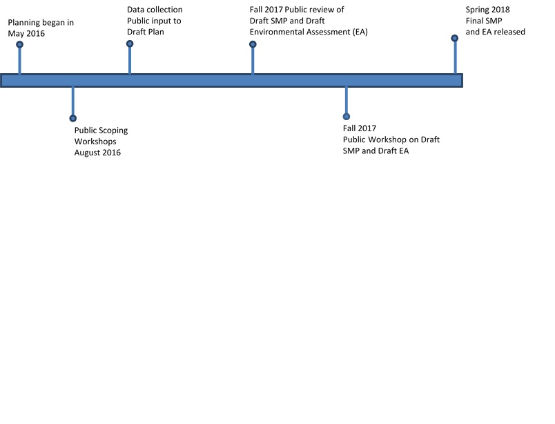
The original Bull Shoals Lake Shoreline Management Plan (also known as the Lakeshore Management Plan) was approved in 1973 with an approved revision in 1982. This plan was reviewed again and updated with additional public involvement in 1988. The most recent Lakeshore Management Plan for Bull Shoals Lake was approved by the Division Engineer, Southwestern, in October 1988. Revision of 36 CFR 327.30 in 1990 required the Little Rock District to convert its currently approved lakeshore management plans to shoreline management plans. The Shoreline Management Plan was approved by the Southwestern Division Office on 1 April 1993. In 1994, public workshops were held during the month of May to notify the public of the Shoreline Management Plan review. The plan was approved on 19 August 1994. In 1999, the SMP was once again publicly reviewed. An updated SMP was signed in March 2001.
Bull Shoals Lake was authorized for five missions: Flood control, generation of hydroelectric power, recreational opportunities, fish and wildlife, and storage to provide water supply (Municipal & Industrial water supply). Bull Shoals also provides water for “minimum flows” as directed by law (Section 132 of the Fiscal Year 2006 Energy and Water Resources Development Act, P.L. 109-103).
White River Minimum Flows
Minimum flow is the release of water into the tailwater on the downstream side of the dams when water is not being released for hydropower generation or flood control. Corps officials said it will benefit trout and non-game species in the tailwater by increasing the wetted perimeter.
The value of trout fishing in Arkansas, mostly below Corps dams, exceeds $130 million, with about half the anglers coming from outside the state. Outfitters and business owners have pitched the benefits of minimum flows since the hydropower plants at these two dams first came on line in the 1940s and 50s and began releasing cold water from deep within the lakes.
Because power generation is intermittent, the demand for electricity rises and wanes during the course of any given day. This leaves periods of time when no cold water is being released. The streams shrink to disconnected pools of water that begin to warm in the summer sun. This can threaten trout survival. Also, the shrunken ‘wetted perimeter’ decreases available habitat.
Minimum flows will ensure a slow but steady stream of cold water. A constant minimum flow also raises the river level and inundates shoreline areas that are dry in low-water periods. This will make more food available for trout. It also increases the amount of overall trout habitat, and makes more cover and structure available for trout.
To provide the water necessary for minimum flow, the Corps raised the level of Bull Shoals Lake 5 feet to establish a new conservation pool elevation of 659 feet MSL. It also modified some equipment in the hydropower plant. Minimum flow on the North Fork of the White River required raising the level of Lake Norfork 1.75 feet and installing a siphon through the dam. The siphon pulls water from various depths of the lake and releases it into the tailwater.
The tradeoff caused by the storage reallocations is a small reduction in the ability to capture storm water and reduce downstream flooding. Bull Shoals will lose slightly more than 1 percent of its flood storage capacity, and Norfork Lake will lose less than a percent of its capacity.
On Jan. 19, 2012, Little Rock District and the Arkansas Game and Fish Commission signed a Project Partnership Agreement that outlined responsibilities for each agency to implement at Bull Shoals. The two agencies signed a similar agreement in 2010 for Norfork.
Ultimately, minimum flows should decrease trout mortality in hot weather and improve the overall health of the trout fishery by reducing the physical stress that accompanies warm water and low levels of dissolved oxygen.
What is a Shoreline Management Plan?
The Bull Shoals Lake Shoreline Management Plan is the required USACE approval document (ER 1130-2-406) that protects and manages the shorelines of all Civil Works water resource development projects under Corps jurisdiction in a manner which will promote the safe and healthful use of these shorelines by the public while maintaining environmental safeguards to ensure a quality resource for use by the public.
The Bull Shoals Lake Shoreline Management Plan main objectives are to manage and protect the shoreline, to establish and maintain acceptable fish and wildlife habitat, aesthetic quality and natural environment conditions and to promote the safe and healthful use of the lake and shoreline for recreational purposes.
SMP Shoreline Allocations
On Bull Shoals Lake, shoreline may be allocated into one of these categories:
• Limited Development Areas—Areas where boat docks and other shoreline use activities are permitted.
• Public Recreation Areas—Area adjacent to or within parks which restricts the issuance of shoreline use permits.
• Protected Shoreline Areas – Areas designated to protect aesthetic, environmental, and fish and wildlife values. No boat docks or other shoreline use permits are allowed in these areas.
• Prohibited Access Areas—Areas immediately upstream from the dam where private docks and shoreline uses are prohibited for safety and security reasons.
(These four shoreline allocations are designated by 36 CFR 327.30 and ER 1130-2-406)
Project Timeline