An official website of the United States government
Here's how you know

Official websites use .mil

A .mil website belongs to an official U.S. Department of Defense organization in the United States.

Secure .mil websites use HTTPS

A lock (lock ) or https:// means you’ve safely connected to the .mil website. Share sensitive information only on official, secure websites.
Skip to main content (Press Enter).
US Army Corps of Engineers
Little Rock District Website
Little Rock District
®
  • About
    • District Map
    • FAQ
    • Leadership
    • Who We Are
    • District Placemat
    • Organization Chart
  • Business With Us
    • America the Beautiful Passes
    • Contracting
    • Navigation Charts
    • Regulatory Permits
    • Small Business
    • Safety Office
  • Missions
    • Civil Works
      • Engineering and Construction
      • Levee Safety Information
      • Floodplain Management Services and Silver Jackets
      • Section 408
      • Illinois River Flood Study
      • White River Basin Study
      • Black River Hydrologic Analysis
    • Disaster Response
      • Levee System Status
    • Military Missions
      • Formerly Used Defense Sites
      • Military Construction
    • Navigation
      • Navigation Notices
      • Channel Reconnaissance Reports
      • David D Terry MRER Status
      • Nav Notices App
    • Planning
      • Approved Project Review Plans
      • Prairie Creek, Russellville, Arkansas
      • Three Rivers Study
      • Millwood Lake Master Plan Revision
      • Norfork Lake Master Plan
      • MKARNS Master Plan Revision
      • Maumelle River Ecosystem Restoration Study
      • Nimrod Blue Mountain Master Plan
      • MKARNS 12-foot Channel
      • Stump Creek Flood Risk Management
      • Norfork Lake Master Plan Revision Page
      • Mortar Creek Stream Bank Protection
        • Mortar Creek Documents
      • Lake Dardanelle SMP Update
    • Real Estate
      • Beaver Lake Land Acquisition
    • Recreation
      • Lakes
        • Beaver Lake
        • Blue Mountain Lake
        • Bull Shoals Lake
        • Clearwater Lake
        • DeQueen Lake
        • Dierks Lake
        • Gillham Lake
        • Greers Ferry Lake
        • Millwood Lake
        • Nimrod Lake
        • Norfork Lake
        • Table Rock Lake
      • Arkansas River
        • Arkansas River Recreation
      • Water Safety
    • Regulatory
      • Applying for a Permit
      • Contact Information
      • Fayetteville Shale Information
      • FEMA Information
      • Mitigation Information
      • Monthly Reports
      • Public Notices
      • Arkansas Special Resource Waters
      • Missouri Special Resource Waters
      • Types of Permits
      • Useful Links
      • Water Resources Development Act
      • Wetlands
      • What is the Regulatory Program
      • Requirements/Exemptions for Flood Recovery Activities
    • Water Management
      • About Water Management
      • Real Time Data (Reservoir)
      • Real Time Data (Arkansas River Nav. Channel)
      • Water Management FAQ
      • Beaver Lake Dam IRRM
  • Locations
    • USACE Locations
    • District Maps
  • Careers
    • Retiree Information
  • Media
    • Images
    • News Releases
    • News Stories
  • Library
    • Arkansas River Navigation Chart
    • District Library
    • USACE Publications
  • Contact
    • Contact Little Rock District
    • USACE Office Locator

Home / Missions / Navigation


McClellan-Kerr Arkansas River Navigation System

445 miles of navigable waterway connecting Oklahoma and Arkansas to the world

18 Locks & Dams
445 Miles
12M Tons Annually

Quick Navigation Links

Navigation Home
Navigation Notices
Recon Surveys
David D. Terry L&D MRER

From Steamboat to Modern Waterway

Historical steamboat on Arkansas River

The story of navigation on the Arkansas River begins long before the modern waterway existed. In 1820, the COMET became the first steamboat to navigate the Arkansas River, reaching Arkansas Post about 40 miles above the confluence with the Mississippi on March 31. Its arrival was celebrated as a remarkable achievement, even as observers recognized how close the river had come to stopping the vessel altogether. In those early years, the uncontrolled river swung wildly between nearly dry conditions and dangerous floods, making reliable navigation impossible. Still, the COMET’s journey captured the imagination of people who understood that the economic future of the rich Arkansas Valley depended on a dependable, year-round waterway reaching deep into what is now Oklahoma.

Two years later, on March 22, 1822, the steam packet Eagle became the first steamboat to reach Little Rock. Arkansas’ Secretary of State history timeline notes this as the first steam vessel to travel that far upriver, an early milestone in Arkansas River transportation and commerce. Together, the COMET and the Eagle demonstrated both the promise and the limitations of the natural river, reinforcing the region’s long held dream of a navigable channel that could support sustained economic growth.

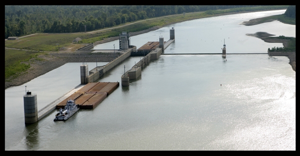
A century and a half later, that dream was realized. In 1970, after more than 25 years of construction by the U.S. Army Corps of Engineers, a 445-mile-long waterway with 17 locks and dams opened to navigation. In July 2004, an eighteenth lock and dam was added at NM 0.5 on the White River Entrance Channel. Because of the scale and complexity of the project, the waterway would never have been built without the persistent efforts of countless Arkansans and Oklahomans in both public and private life.

In 1971, Congress officially named the system the McClellan Kerr Arkansas River Navigation System (MKARNS) in honor of two of its most influential champions, U.S. Senators John L. McClellan of Arkansas and Robert S. Kerr of Oklahoma.

Navigation Resources & Reports

Navigation Notices & Status

  • Notices To Navigation Interests (NTNI)
  • SWL Navigation Notices
  • Channel Reconnaissance Reports
  • MKARNS-AR Channel Status Report
  • USACE Locks (Nationwide)

Tonnage Reports (Recent)

  • February 2026 Tonnage
  • 2025 Annual Tonnage
  • 2024 Annual Tonnage
  • 2023 Annual Tonnage
  • 2022 Annual Tonnage
  • 2021 Annual Tonnage

Historical Tonnage (2012-2020)

  • 2020 Tonnage
  • 2019 Tonnage
  • 2018 Tonnage
  • 2017 Tonnage
  • 2016 Tonnage
  • 2015 Tonnage
  • 2014 Tonnage
  • 2013 Tonnage
  • 2012 Tonnage

MKARNS Waterway Action Plan

River vessel with barges in tow on river
  • 2023 MKARNS Waterway Action Plan (PDF)

Regulations & Safety

  • MKARNS Regulations - Red Book
  • Safety While Locking Through
  • Turtle Book - Locking Through Guide

Points of Contact

Navigation & Maintenance
(501) 324-5739
Reservoir Control
(501) 324-6237
Pine Bluff Project Office
(870) 534-0451
Russellville Project Office
(479) 968-5008
Montgomery Pt L&D
(870) 548-3400
Norrell Lock
(870) 548-2796
Lock No. 2
(870) 548-2791
Joe Hardin Lock
(870) 479-3164
Emmett Sanders Lock
(870) 534-2127
Col Charles D. Maynard Lock
(501) 842-2761
David D. Terry Lock
(501) 961-9281
Murray Lock
(501) 663-1997
Toad Suck Ferry Lock
(501) 327-0853
Arthur V. Ormond Lock
(501) 354-8402
Dardanelle Lock
(479) 890-4987
Ozark-Jeta Taylor Lock
(479) 209-4181
James W. Trimble Lock
(479) 452-0488

U.S. Army Corps of Engineers - Little Rock District

McClellan-Kerr Arkansas River Navigation System

ESSAYONS
Our Mission

Deliver vital engineering solutions, in collaboration with our partners, to secure our Nation, energize our economy, and reduce disaster risk.

About the Little Rock District Website

The official public website of the Little Rock District, U.S. Army Corps of Engineers. For website corrections, write to ceswl-pa@usace.army.mil

  • Plain Language
  • Accessibility
  • Contact Us
  • Quality Facts
  • Link Disclaimer
  • Privacy & Security
  • Site Map
  • USA.gov
  • No Fear Act
  • EEO & SHARP
  • Small Business
  • Open Government
  • IG
  • FOIA
  • iSALUTE
U.S. Army USACE 250th Logo
Hosted by Department of War Information Activity - WEB.mil Veterans Crisis Line number. Dial 988 then Press 1