us army corps of engineers logo - white castle on red background

DeQueen Lake 

Contact Us

Contact Information
DeQueen Field Office
706 DeQueen Lake Road
DeQueen, Arkansas, 71832
(870) 584-4161

Dam and Lake Information

The DeQueen Dam and outlet works.

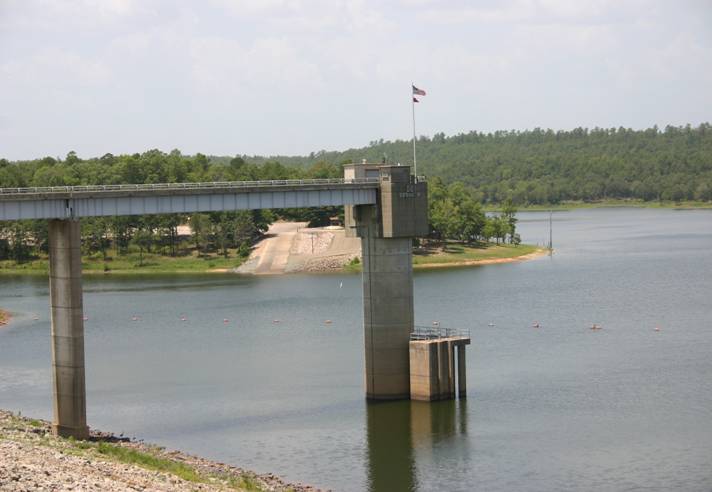
Location: DeQueen Lake is located on the Rolling Fork River in Sevier County about four miles northwest of the city of DeQueen, Arkansas.

Purpose: The Authorized purposes of DeQueen Lake are to provide flood control, water supply, water quality, recreation and fish and wildlife enhancement.

Construction: the Flood Control Act approved July 3, 1958 authorized DeQueen Lake for construction. The project was designed by the Tulsa District, U.S. Army Corps of Engineers and built under the Corps’ supervision. Construction on the project was started in April 1966 and the lake went into operation August 31, 1977.

Click here to see what's open at Dequeen Lake!

Campgrounds

Collapse All Expand All
 Bellah Mine

Description: Bellah Mine Park is located on the northern end of DeQueen Lake. The park includes 20 shaded campsites some of which are located on the water.

Location: Bellah Mine can be reached from DeQueen, AR., by taking US Highway 71 N for 7 miles to Bellah Mine Road. Travel Bellah Mine Road west for 5 miles, following signs into the campground.

Facilities: 24 campsites with electricity and water, showers, flush toilets, trailer dump station, picnic areas, picnic shelter and a boat ramp.

Fees: $14-$16 (March 1-Oct. 31) - $10 (Nov. 1-Feb. 28). Picnic shelter rental $25.

Reservations: Bellah Mine, Dequeen Lake - Recreation.gov

Open: Year-Round.

Contact us at 870-386-7511 for any questions concerning your stay at Bellah Mine Park


 Oak Grove

Description: Oak Grove has 36 campsites although shade is limited on most sites, pavilions provide shade on most campsites. Campsites are not located on the shoreline or near the water.  A group camping area with pavilion and tent sites is available.

Location: Oak Grove Park can be reached from DeQueen, AR, by traveling 3 miles north on US 71, then 5.3 miles west on DeQueen Lake Road, then 0.3 miles north on Corner. Follow signs into the campground.

Facilities: 36 sites with water and electricity, trailer dump station, showers, flush toilets, playground, amphitheater, boat ramps, swim beach, picnic areas, and 1 picnic shelter.

Fees: Sites with electricity - $14-$16 (March 1-Oct. 31) $10 (Nov. 1- Feb. 28)
Picnic Shelter - $25 (March 1-Oct. 31).

Open: Year-Round.

ReservationsOak Grove (AR), Dequeen Lake - Recreation.gov

Contact us at 870-642-6111 for any questions concerning your stay at Oak Grove or Pine Ridge parks
 

 Pine Ridge

Description: Pine Ridge park includes 17 campsites with sites located on the water. A mix of pine and hardwood trees offer shade to all campsites.

Location: Pine Ridge Park can be reached from DeQueen, AR., by going 3 miles north on US 71, then 5.5 miles west on DeQueen Lake Road, then 1.5 miles west on the county road.

Facilities: 17 campsites with water and electricity, showers, flush toilets, trailer dump station, picnic shelter and  boat ramp.

Fees: Sites with electricity and water - $14-$16 (March 1-Oct. 31) $10 (Nov. 1- Feb. 28) Picnic shelter $25 per day. All reservations and payments are made at the Gate Shack located in Oak Grove park

ReservationsPine Ridge, Dequeen Lake - Recreation.gov

Contact us at 870-642-6111 for any questions concerning your stay at Oak Grove or Pine Ridge parks