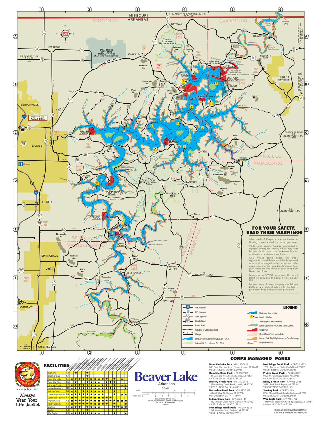
Nestled high in the Ozark Mountains, Beaver Lake is a man-made reservoir that covers more than 487 miles of visually stunning Northwest Arkansas shoreline.
Surrounded by 12 parks and more than 2,000 acres of campgrounds, the land surrounding Beaver Lake offers hiking, cycling, and some of the best fishing and paddle boarding in Arkansas. With so many recreational opportunities it is no wonder that Beaver Lake is one of the focal points for both work and play in the region.
Yet, as beautiful as the lake is, recreation was not what it was made for. Created after the 1966 completion of the Beaver Dam, the lake was part of a comprehensive flood control plan meant to protect the White River Basin. Working as a single system, the lakes of the basin were meant to reduce both the frequency and severity of floods both in the region and downstream as the White eventually joins the Mississippi River.
While the mission of the White River Basin lakes and the levee systems that support them have not changed, the world that they exist in has become larger and more complex. Along with flood control, the lakes are also responsible for hydropower generation, drinking water, and a recreation mission that according to a 2016 study of the economic impact of USACE operations, sees more than 15 million visitors a year and is worth more than $650 million to local economies.
It is this confluence of competing interests that have created both opportunity and conflict in the regions surrounding the lakes – and Beaver Lake in particular.
It’s more than just a pretty lake
Beaver Lake is slowly being encircled by the Northwestern Arkansas Metropolitan Area, often just called Northwest Arkansas. Home to more than half a million people, as well as the headquarters of three Fortune 500 businesses, NWA has experienced rapid growth in both investment and opportunity. According to the Bureau of Economic Analysis, the size of the NWA economy in 2001 was $13.3 billion. Today, the combined gross metropolitan product of NWA has grown to $23.5 billion, an increase that the Sam Walton College of Business at the University of Arkansas says makes NWA the 14th fastest growing metro area in the nation.
As the region grows, so too does the burden put on Beaver Lake as a source for clean drinking water. The water districts that surround the region each have an allocation of space within the lake’s conservation pool. The largest of these, the Beaver Lake Water District, supports an average daily consumption in the region that tops 45 million gallons per day.
So while it’s easy to worry about hundreds of thousands of thirsty Arkansans doing their best to drain Beaver Lake, the demands on the lake are further complicated by its hydropower generation mission. Beaver Dam’s two generating units annually produce more than $8 million in revenue through Southwest Power Administration sales. These dollars are used to maintain the generating and transmission facilities as well as provide dollars to supplement lost property tax to counties that have land submerged under the lake.
So while the lake supports clean drinking water and the national electrical grid, the recreation it provides makes it a center of commerce in and of itself. According to the Ozarks Water Watch, a clean water watchdog group in NWA, the spending in and around Beaver Lake is worth an estimated $30.24 million annually to the local economy.
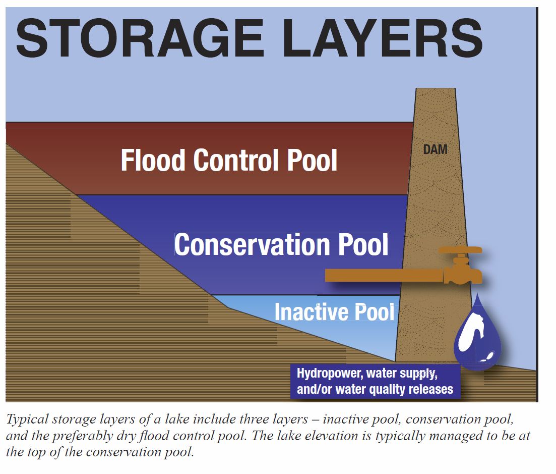
These recreation centric dollars and the ongoing growth opportunities that it creates brings with it a new challenge: the desire for stable lake-levels. Beaver Lake is made up of layers of water that include a conservation pool, and a flood pool. The conservation pool of the lake is dedicated to providing drinking water and hydropower, it also makes up the most enjoyable and usable body for recreating. Lake levels near or at the top of its conservation pool make for a sort of goldilocks-zone for those wishing to fish, boat, or use personal watercraft. The Corps understands this, and appreciates the recreation demands that NWA place on Beaver Lake, but they don’t adjust the level of the lake to support it.
“Recreation is a wonderful way to use the lake,” says Little Rock District Chief of Water Management, Nathaniel Keen, “but our water management decisions are made to reduce flood and drought risks.”
It’s a stark reminder to those that live and work around the lake. Recreation is important, but it’s not why the lake was built.
Compromise and Balance
As the population of businesses, and private home owners that live downstream of the lake continues to grow, so too have demands for power, clean drinking water, and stable water levels for recreation.
The Corp of Engineers, entrusted with maintaining the lake as a viable and functional means of flood control, often interacts with stakeholders that are at odds with each other, since each have their own specific issues with how the flood control mission is managed.
Beaver, as the most upstream lake in the chain of lakes that impound the White River, provides supplementary flood storage for Table Rock and Bull Shoals. To manage these lakes and ensure that there is always enough (but not too much) water in each lake’s flood pools, the Corps of Engineers utilize a water control plan. While there is lot of information that goes into making a water control plan, at its heart, it’s simply a guide that the Corp uses to determine how and when water is stored and released. That said, it’s a guide that they’re required by law – to follow.
How does this affect Beaver Lake?
Perhaps the most important thing to understand about the White River chain of lakes is that each of them are managed as a single system. Beaver, along with Table Rock, Bull Shoals, and Lake Norfork work together to reduce the damage and severity of floods – which means that their associated flood pools must be managed to balance risks. This ensures that there is enough remaining storage to allow for unexpected spikes in rainfall or runoff in each lake’s watershed. It also ensures that there is not too much or too little water being released into the White River based on seasonal requirements.
While this balancing act can be complex, computer simulations of 78 years of river data show that maintaining proper balance of available flood storage between these lakes ensures the best flood damage reduction to the lower White River Valley.
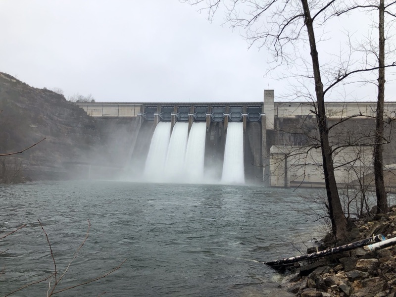
What’s frustrating for recreation users – as well as business and home owners - around Beaver Lake, is that this multi-lake system creates a situation where Beaver holds water higher in its flood pool for longer than the other lakes. In fact, releases from Beaver are significantly limited when either Bull Shoals or Table Rock are more than 2 feet into their flood pool. This relationship makes sense when you consider the sizes of the flood pools in each lake, and need to balance risk across the entire system of lakes. Yet in spite of this, the high lake levels and the irregular release schedule at Beaver Dam regularly become a points of contention.
“Beaver, as the first lake in the chain, provides supplemental flood storage for Table Rock and Bull Shoals, says Keen. “If we release floodwater stored in Beaver into Table Rock and Bull Shoals while they are already storing floodwater, we use up more storage capacity in those two lakes. If additional rain falls in the Table Rock and Bull Shoals drainage basins, they will fill even more, while Beaver Lake’s flood pool sits empty and unable to help. Remember, once the water leaves Beaver Lake, we can’t put it back. On the other hand, if more rain falls in the Beaver drainage basin and fills its storage capacity, we can simply move some of the floodwater into Table Rock and Bull Shoals at that time. This is all in accordance with the water control plan, which has been carefully thought out and reviewed multiple times over the years. To do otherwise would increase flood risks all along the White River downstream of Beaver Dam.”
Regulating the White River
For home owners on the White River downstream from Beaver Dam, a different concern appears when the Corp begins to lower the flood pool. Most of the time, the releases are fairly limited, but when conditions at Table Rock and Bull Shoals allow, Beaver Dam will begin to aggressively evacuate water from Beaver’s flood pool to bring the lake level down. As the White River begins to rise, home owners and dock owners are all impacted as the increased flow can wash away docks that are not secured, and in certain conditions, threaten private property built near the water’s edge.
While the Corp works very hard to coordinate their releases with the public, there can be friction. Lake users waiting on lower pool levels at Beaver are often frustrated and confused at why Beaver is held high for so long. They don’t realize that the Corp is waiting on the conditions in Table Rock and Bull Shoals to be optimal before releasing more water downstream. The focus of concern shifts once releases start, as downstream home owners worry when they see the river start to rise. As they watch the river get faster, and grow closer, they start wondering when the Corp is going to finally “turn off the tap”. For both user groups, the concern is understandable, but most of it is due to not realizing that the Corp is following a playbook – the water control plan – which guides their decisions to hold water or release it.
That said, the water control plan is more than just a “playbook”. It’s an agreed upon set of rules and instructions that the Corp is compelled - by law - to follow. The directions it provides are not a loose guideline, but an agreed upon series of requirements that ensure each lake in the system is capable of meeting its congressionally authorized purposes.
Over the decades, the Corps of Engineers flood control lakes have prevented a staggering amount of flood damage. But they are not able to remove all risk entirely. Mother Nature has a long and storied history of throwing mankind curve balls in the form of repeated severe weather events that strain the entire system. It’s because of this, that the Corps recommends that anyone with (or considering) investments along the White River to prepare for the risks by being familiar with the Water Control Plan – (summarized into an easy to digest form here: http://www.swl-wc.usace.army.mil/pages/docs/White_River_Master_Manual.pdf). The more home and business owners understand the constraints of the plan, and how they fit within it, the better decisions they can make.
“Ultimately, the Corps does its best to balance the needs of those living downstream of the lakes, but those needs can be very specific and often conflict,” said Col. Eric Noe U.S. Army Corps of Engineers Little Rock District Commander and Engineer. “Some industries ask for lower river stages during the growing season, while others would prefer the levels be higher.”
Hydropower benefits from high pool levels in the lakes, but when the lake is high, it can stymie recreation and that’s hard on businesses that prosper from lower pool levels. Ultimately, the Corps water control plan has to acknowledge all these needs, and the end result is a compromise across all of them.
So what about recreation?
In the wake of the Flood Control Act of 1936, Congress originally tasked the Corp to build lakes, levees, and dams throughout America. This kicked off a massive civil works initiative that was intended to reduce the severity of floods, provide hydropower, and support clean drinking water. While not the central focus of the initiative, lawmakers believed that it was important that recreation be supported and allowed. That said, recreation does not enjoy an equal footing against the lakes primary focus – flood control. So when the Corp is faced with making a decision about the water levels in one of its lakes, it follows the water control plan, which does not include provisions for recreation.
Looking to the future
One has to wonder if the original engineers designing Beaver Lake could have imagined that the lake would allow NWA to grow so incredibly fast. Intended to prevent floods, Beaver and the other lakes of the White River Basin have done much to enable the economic growth and prosperity. While the people of NWA see and enjoy Beaver Lake for the natural beauty it provides, if they’re aware of how vital a role it plays day-to-day in the survival and growth of the NWA metro area, is hard to quantify. But that’s where the Corp of Engineers has perhaps its most difficult mission of all – and one that they share with multiple environmental and water quality concerns in the region: namely – the protection of Beaver Lake – and ensuring its ongoing viability as a resource for the future.