A "wetland" is an area that is covered by shallow water or has waterlogged soils for long periods during the growing season in most years. Prolonged saturation with water leads to chemical changes in wetland soils, which in turn affect the kinds of plants that can grow in wetlands. Therefore, wetland vegetation often looks quite different from that of the surrounding non-wetland areas.
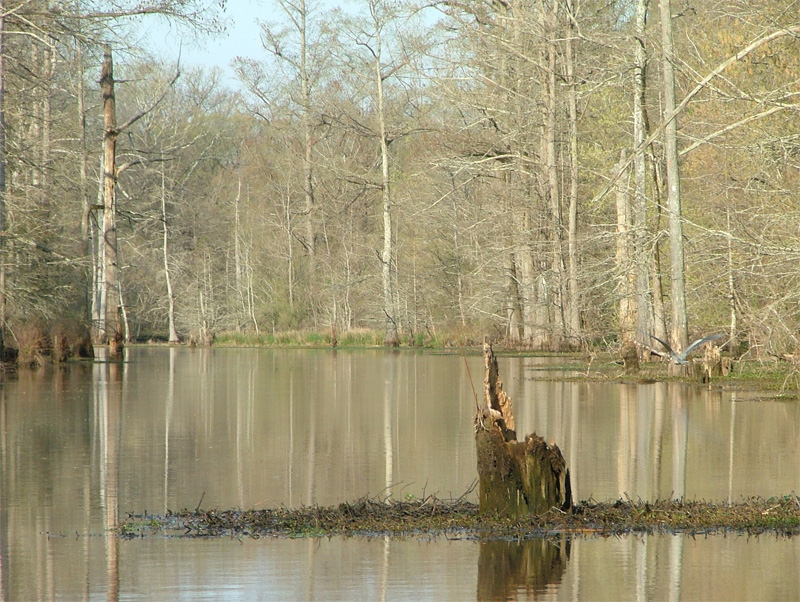
Wetlands are known by many different names, some of which are specific to particular regions of the country. Wetlands that are dominated by trees and shrubs are commonly called swamps. Swamp forests associated with rivers and streams in the Southeast are locally known as bottomland hardwoods. Wetlands that consist of herbaceous vegetation, such as sedges, cattails, and bulrushes, are known as marshes. Marshes are highly variable and include fens, sloughs, potholes, and wet meadows. Bogs are generally dominated by sphagnum moss, which, when it dies, builds up in thick layers of peat. Extensive bogs in Canada and Alaska are called muskegs.
The information presented here will help you to determine whether you have a wetland on your property. If you intend to place fill material in a wetland or in an area that might be a wetland, contact the local District Office of the U. S. Army Corps of Engineers for assistance in determining if a permit is required.
How are wetlands recognized?
The term "wetland" encompasses a variety of conditions and degrees of wetness. Some wetlands are very easy to recognize because the water sits on the land's surface for much of the year. Other wetlands exist due to saturation of the soil by groundwater and can be difficult to identify. Wetlands do not need to be wet year-round. In fact, due to seasonal variations in rainfall and other environmental conditions, most wetlands lack both surface water and waterlogged soils during at least part of the growing season each year.
One clue that a tract of land may contain wetlands is its topography or position in the landscape. Wetlands occur in areas where water naturally flows or accumulates, such as in the floodplains of streams and rivers, along smaller creeks and washes, in low spots or depressions in flat or rolling landscapes, around seeps and springs, along the fringes of ponds and lakes, and in coastal areas affected by tides.
Even in fairly obvious wetland situations, it may be difficult to determine where the wetland ends and the upland begins. Therefore, identification of wetland boundaries (a procedure called wetland delineation) is a task best left to a qualified wetland consultant or Corps District personnel. Wetlands are delineated by carefully examining a site for the presence of wetland indicators. Three categories of wetland indicators - vegetation, soil, and hydrology - are explained briefly in the following document.
The Corps' provides a brochure on Recognizing Wetlands.