 In October 1954, construction of Table Rock Dam, at Branson, Missouri, was begun. Beaver Dam had been authorized a month earlier under the Flood Control Act of September 3, 1943. As with other Corps projects, these dams had a long history of proposals, refusals, counter-proposals, delays, despair, investigations, and political involvements. The Table Rock site had been under consideration for a hydroelectric power dam as far back as 1901, when the town of Hollister, Missouri, had surveyed the site for that purpose. When the Corps of Engineers entered the picture in 1928-31 in the midst of an economic depression, it made a negative decision for construction of a dam. The Corps of Engineers did report that the site was well suited for a hydroelectric dam, but added that existing economic conditions did not warrant Federal expenditures or participation.
On the eve of the economic depression of 1929, the Empire District Electric Company, a subsidiary of Cities Service, had purchased a site in the vicinity of the Table Rock site with intentions to construct a small hydroelectric power facility. The depression deferred their immediate ambitions, leaving only the hope of Federal participation for the local communities. The involved communities were well represented by civic minded leaders who were eager to devote their time labor and expenses in promoting such a project.
Unlike the Mountain Home, Arkansas area to the southeast, the Branson area was not one of chronic economic depression. The area was already recognized for its fishing; and during normal times, the community had a rather stable and moderately secure economy based on fishing and recreation, reinforced by agriculture. Lake Taneycomo had been created shortly after World War I as a result of impounded waters restrained by a privately developed power dam (Powersite), and Rockaway Beach was probably the first resort to be built in the State of Missouri. The area was hard hit by the depression, but the economy began to recover its former vitality as the Nation struggled out of its economic disaster.
 If the area did not have an absolute need for a dam to assure economic prosperity, there was no question about the need for a dam to protect property in the downstream reaches from the ravages of the White River. Local citizens have etched memories of bridges being washed out, farms being washed away, houses floating down the turbulent waters, trains being shunted aside, and mud hip-deep in the middle of town. As a result of the recurring disasters the citizens of the river communities were primarily interested in a dam for flood control purposes, with hydroelectric power and recreation as attractive secondary considerations. An unusually disastrous flood in 1935 and President Roosevelt’s “New Deal” to create employment through public works caused Congress to authorize a further study. This time the Corps of Engineers concluded in their report that Table Rock Dam should be built, and the dam was authorized by the Flood Control Act of 1941, for “flood control and hydroelectric power, and other beneficial water uses.”
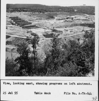
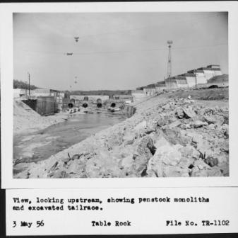
As though to emphasize the need of the dam for flood control, the rains of 1957 brought on flooding conditions while the dam was yet under construction. Some of the monoliths near the center of the dam were still being poured when rising flood waters to the back of the incomplete dam crested over these incomplete monoliths to cascade downstream into the old river bed. Though the waters were sufficiently contained to prevent downstream flooding, the unexpected quick rise in the reservoir surprised property owners who were still in the process of moving their houses and property out of the reservoir area. The towns across from Branson were saved from considerable damage. The flood delayed construction for a short period, but the project was completed in August of 1958 and power production was online in June of 1959. Two additional generating units were completed in April and August of 1961, overall construction was concluded at a cost of approximately $65,420,000.
Table Rock Dam’s spillway capacity was evaluated as a result of a dam safety program in the 1990’s. Using improved weather data and more modern technology and safety requirements, engineers determined that the lake would rise ten feet higher during the worst-case flood than previously calculated. An event of this magnitude would overtop the earthen embankment and destroy Table Rock Dam with catastrophic losses in downstream areas including Branson. To prevent the potential loss of life and property damages, congress approved and authorized construction of the Dam Safety Project. After considering several options and gathering considerable public input, an auxiliary spillway was determined to be the best solution. The auxiliary spillway was completed in 2005 at a cost of apx $65,000,000.